The province of Cebu was declared under state of calamity after three successive natural disasters struck: September 30 earthquake, Typhoon Tino on November 4, and Typhoon Uwan immediately after. (UPDATE: typhoon Verbena has just hit Cebu) As of this writing, many families have yet to return to their damaged homes, businesses closed shop, locals lost their jobs, livelihoods were lost, power has yet to be fully restored, and water remains scarce.
I have been contemplating on hanging up my hiking shoes for good. At 59 nursing a delicate heart condition, I’m considering turning to less physically demanding activities. It’s tough because I love the outdoors. My physician said I can still go out for minor hikes, but as a solo joiner, I find it more and more difficult to keep up with the pace of fellow (younger) hikers. I hold everyone back.
But when I saw a post on FB about a hike for the benefit of Cebu, I didn’t think twice.
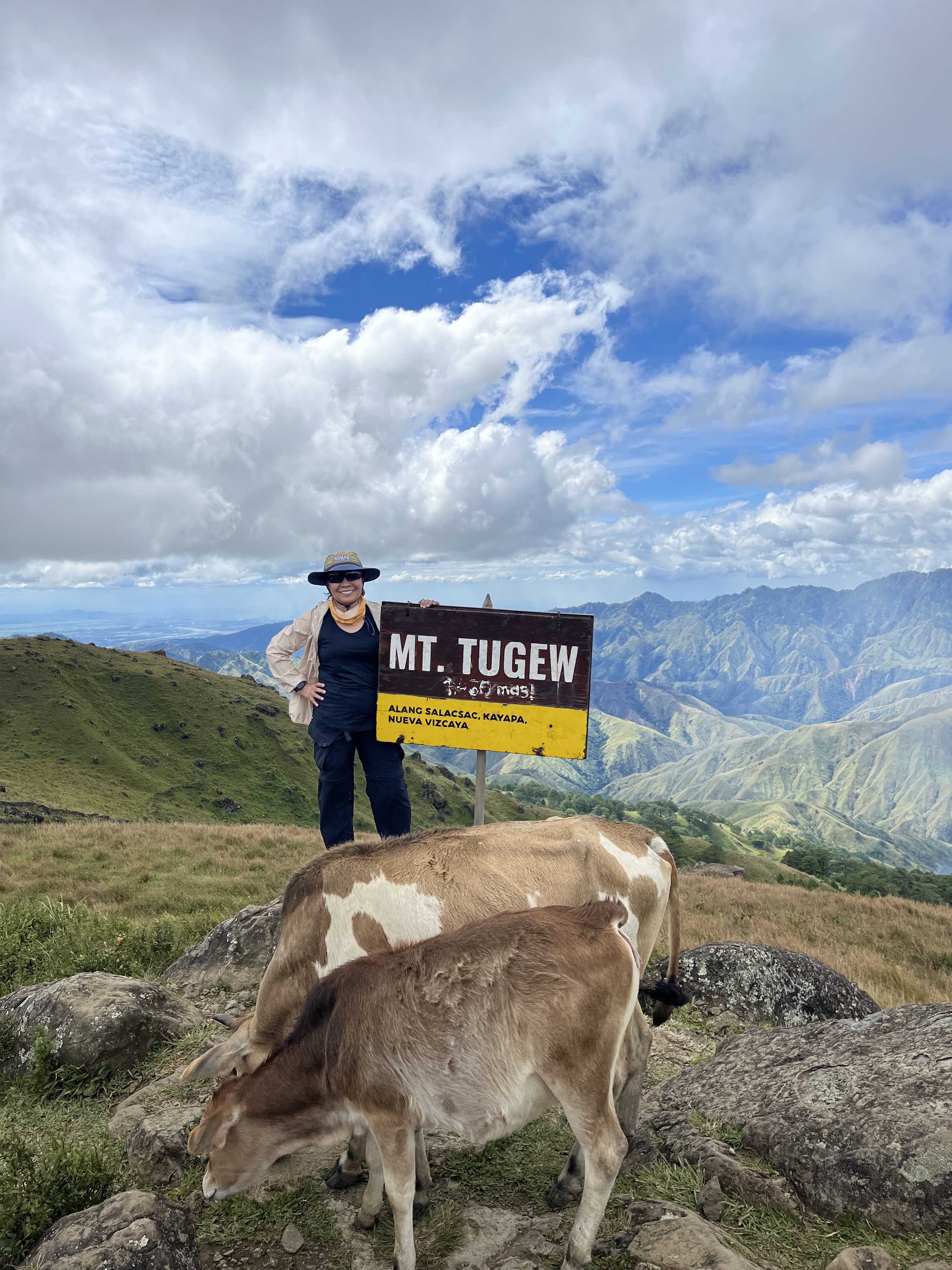
Mt. Tugew (pronounced as “to go”)
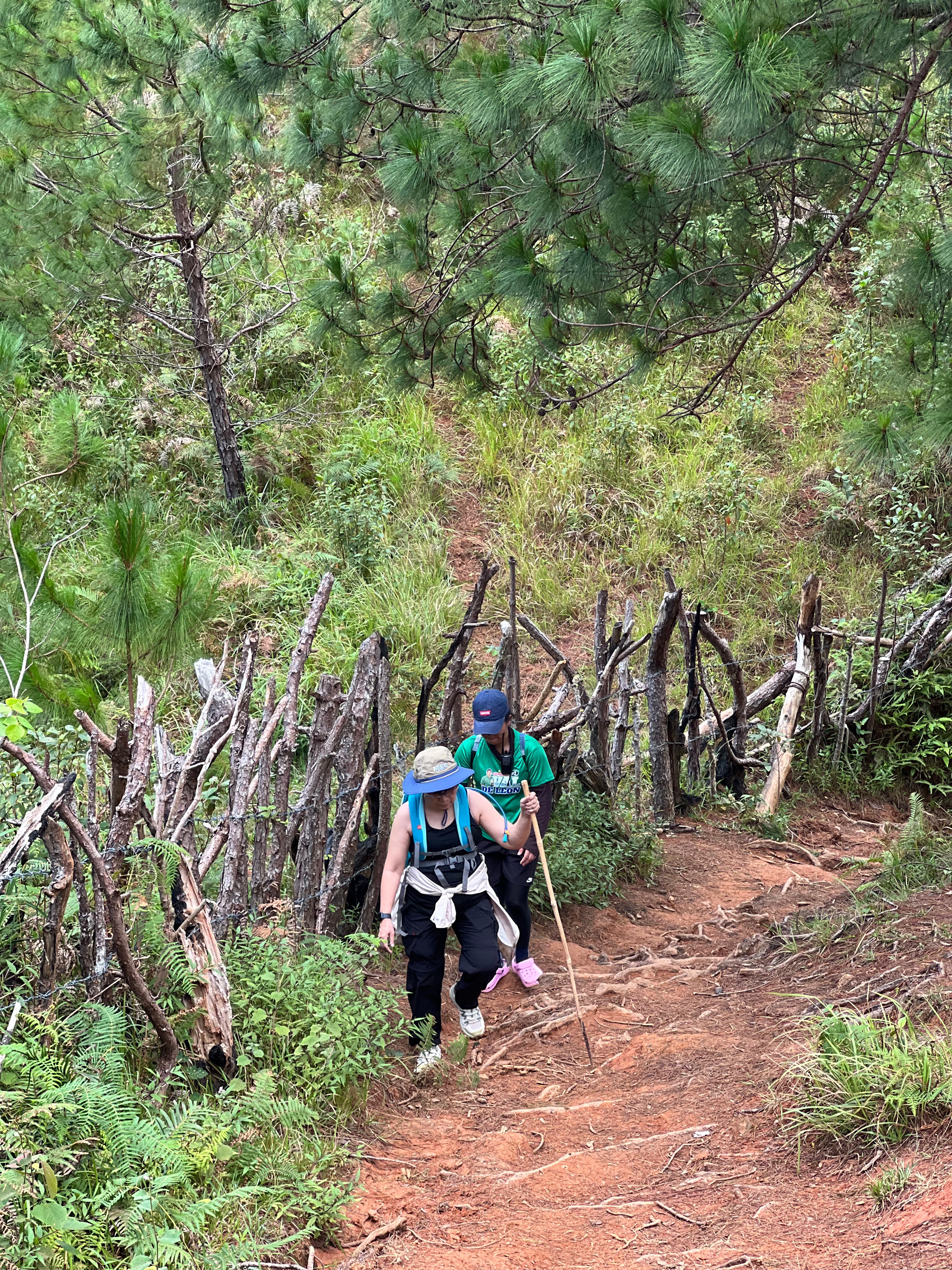
I’m bad at measuring distances, but I think it was about a kilometer’s walk on steep concrete pavement from the barangay hall of Alang Salacsac to the foot of Mt. Tugew. First of all, I don’t know where the measurement actually starts since there were more than one signage that says “this way to Mt. Tugew” along the way. But by the time the cemented uphill walk was over, I was already out of breath.
A few meters further up on the unpaved trail, I told our sweeper guide Anne that she has to be patient with me as I would be taking lots of rests. I would check my heart rate every now and then, pausing for a break whenever it goes over 140 bpm. On my third break, I seriously contemplated on quitting early. I’m out of breath, but there was no chest pain. My heart rate is quick to go down during each rest, so I figured I should be okay.
Also, just like my other hiking trips, this is a form of prayer for me. In this particular hike, it’s for fast recovery for Cebu residents. Proceeds collected from us hikers will also go to them.

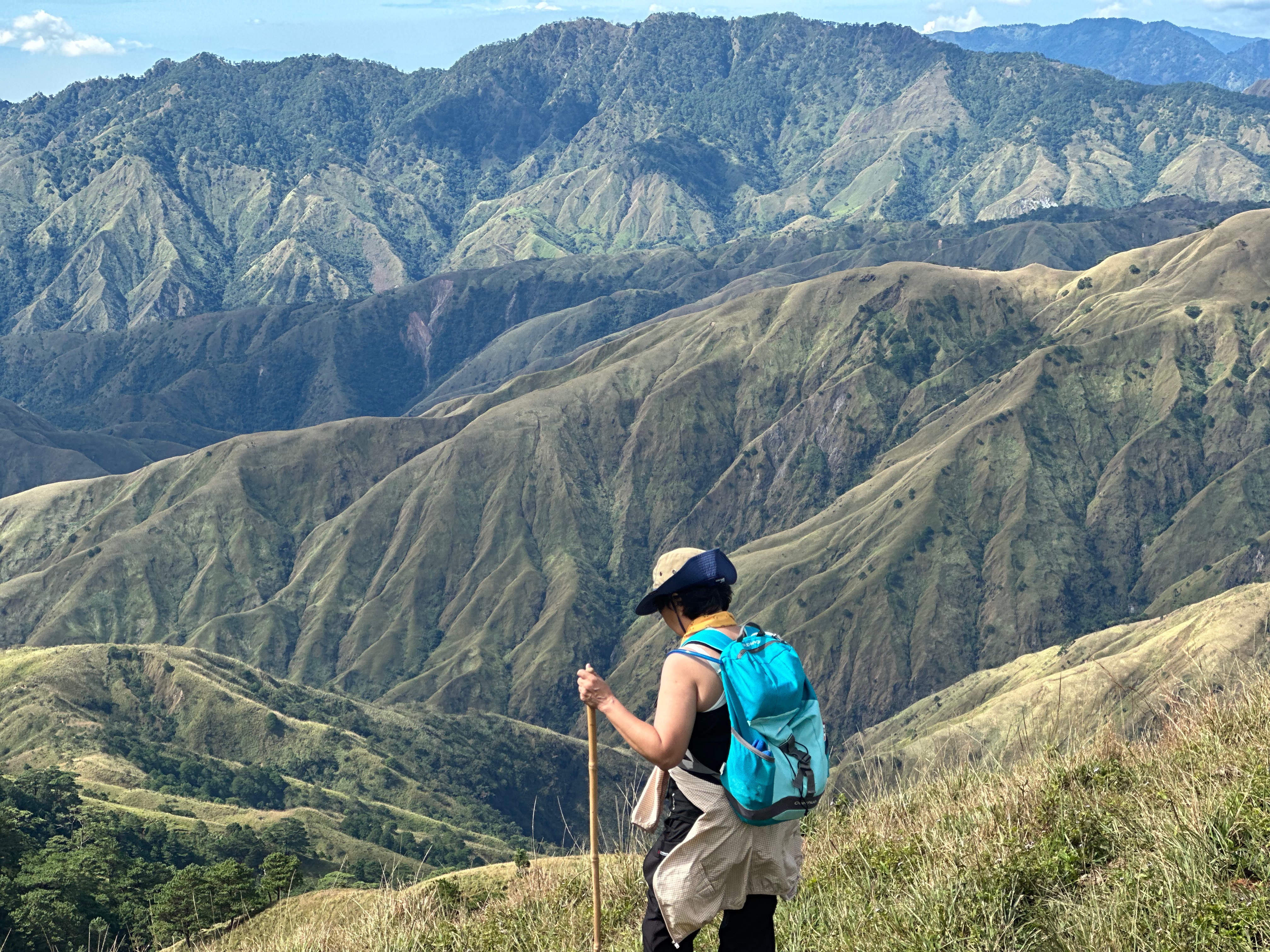
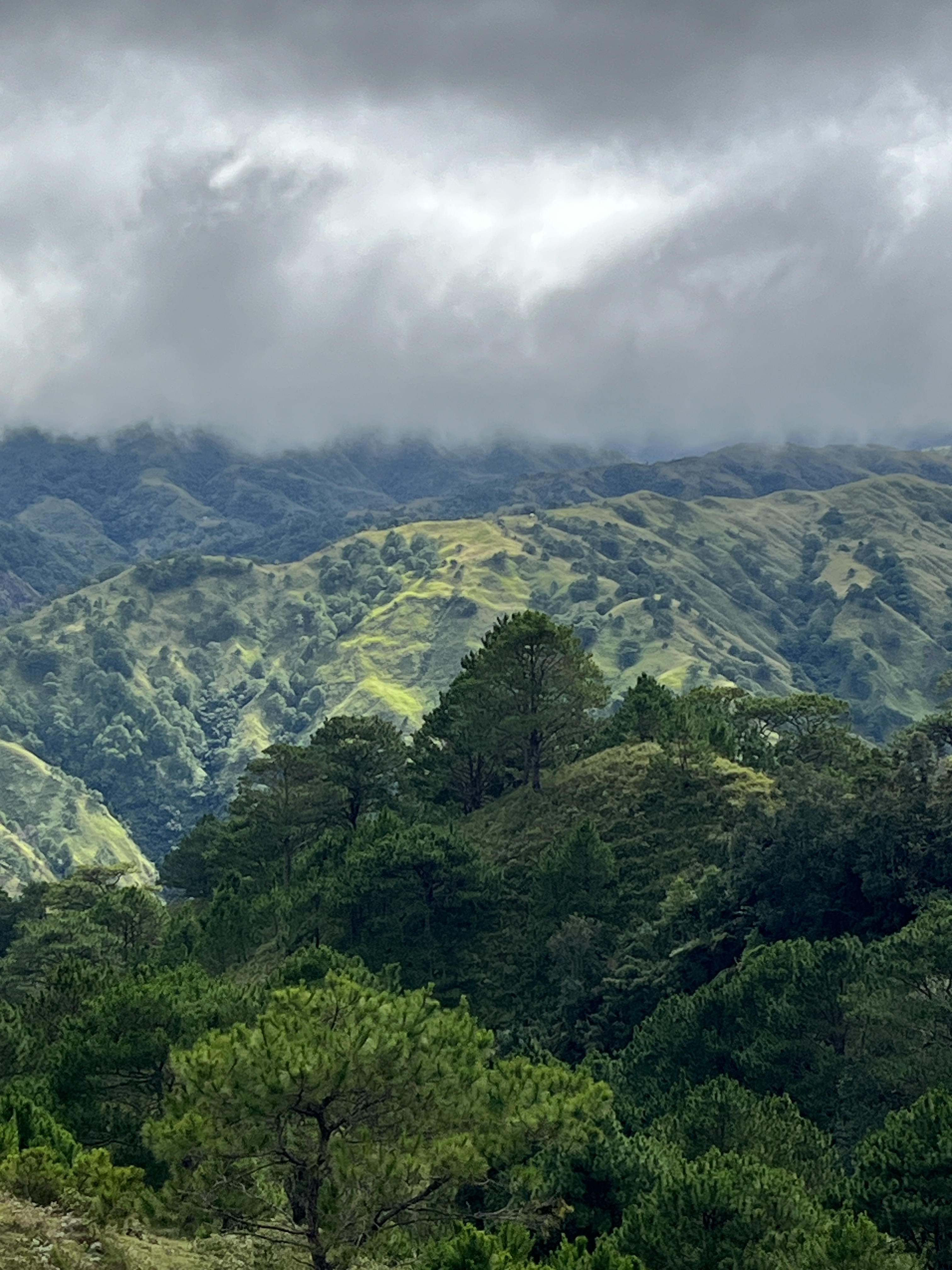
Mt. Tugew rises at 1, 467 meters above sea level, with elevation gain of about 1,430 feet (436 meters). This tri-peak adventure is “beginner-friendly” for the young and the fit, with trail class of 3/9. As it is mostly open trail, I decided to wear a tank top as I was expecting a super hot hike.
I was wrong.
It was extra cold with uber strong winds. While the sun would come out from time to time, intermittent drizzle of rain would also come down. It’s a good thing I brought my windbreaker and a raincoat, but these barely helped against the cold strong wind.
I caught up with the group at the area where a large fallen tree served as a photo op site. It was here where I had the chance to catch my breath, get my bearings, and eat. After all the photos have been taken (there were at least four groups so I had lots of time to rest), we headed for the summit. Of course, I was last once again.
Upon reaching the summit, I found my second wind. The view was stunning wherever I looked. I took deep breaths and closed my eyes briefly in prayer, thanking God for bringing me here and giving me enough strength to make it to the first peak.
The outdoors can truly heal one’s weary soul.


Mt. Cabo
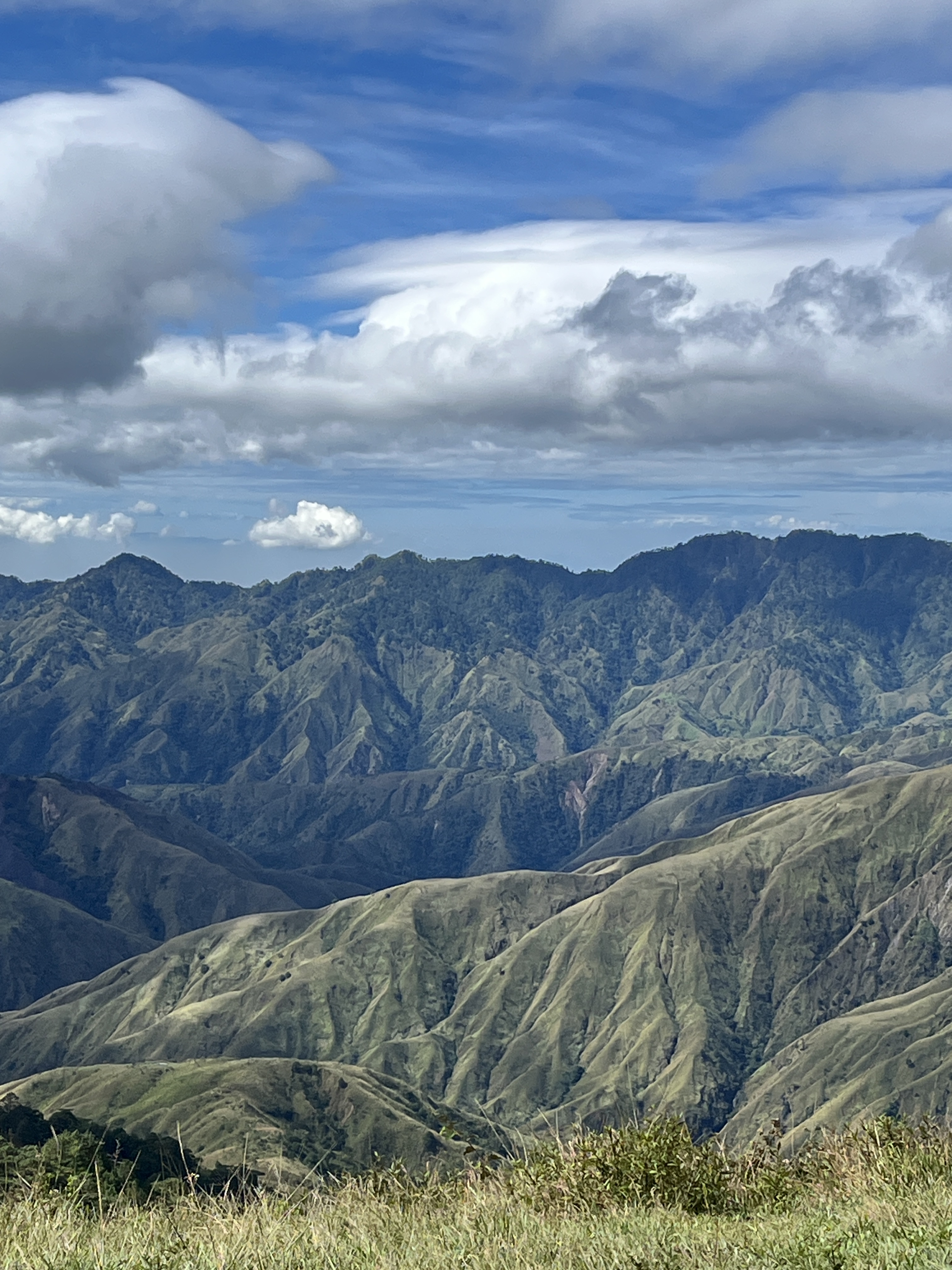
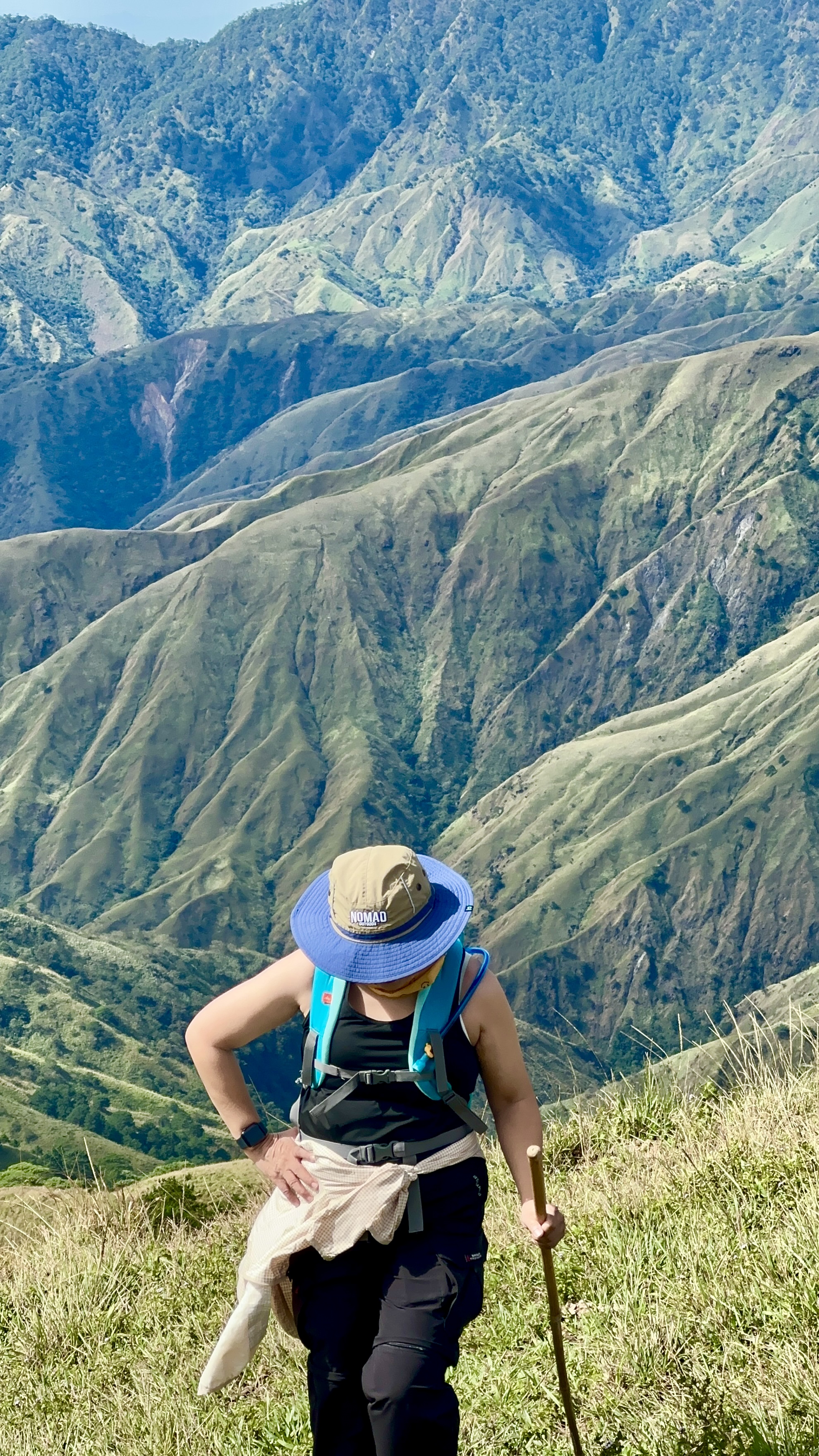
On our way to the second peak, the wind seemed to grow stronger since the trail is completely open. I find myself getting slightly blown off the trail from time to time, and I would either stop to hang on to the walking stick, or squat and hang on to ground to avoid flying away like a human drone. The clouds were getting darker and thicker, but moving faster as if asking me to keep up.


Mt Cabo stands majestically at 1,320 meters above sea level. When taking the Alang Salacsac trilogy (formerly known as Kayapa trilogy within the hiking community), this part would be the best spot to take pictures and drone shots. Since the wind was too strong, no one was able to use their drone camera. It was actually difficult to keep the hands steady even for a decent photo because of the strong wind.
Mt. Kabuan
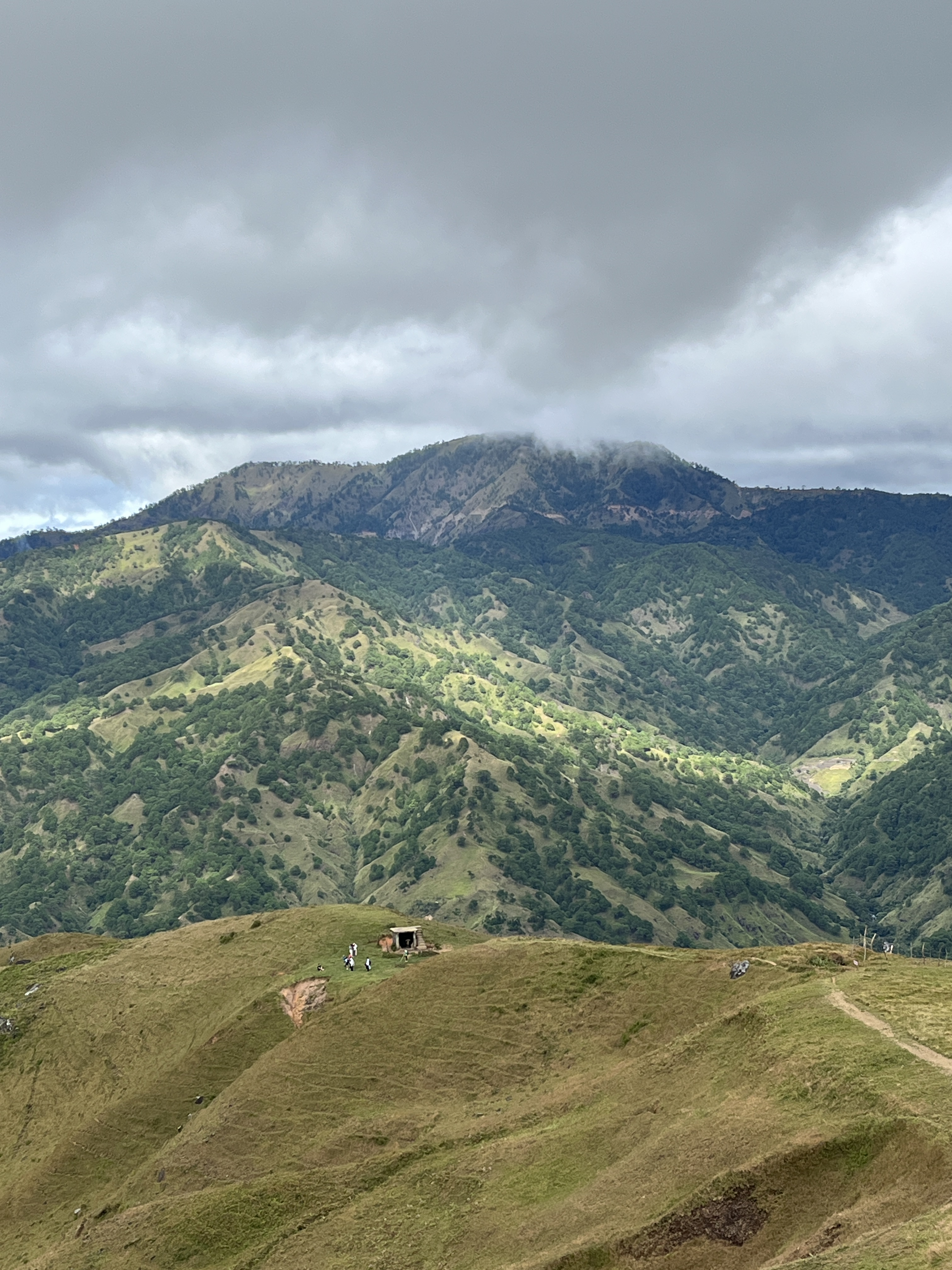
The ascent to Mt. Kabuan reminded me of the final assault toward the summit of Mt. Pulag. It was steep and winding. By the time we reached the summit, moderate rain started to fall, causing us to take quick snapshots by the signboard.
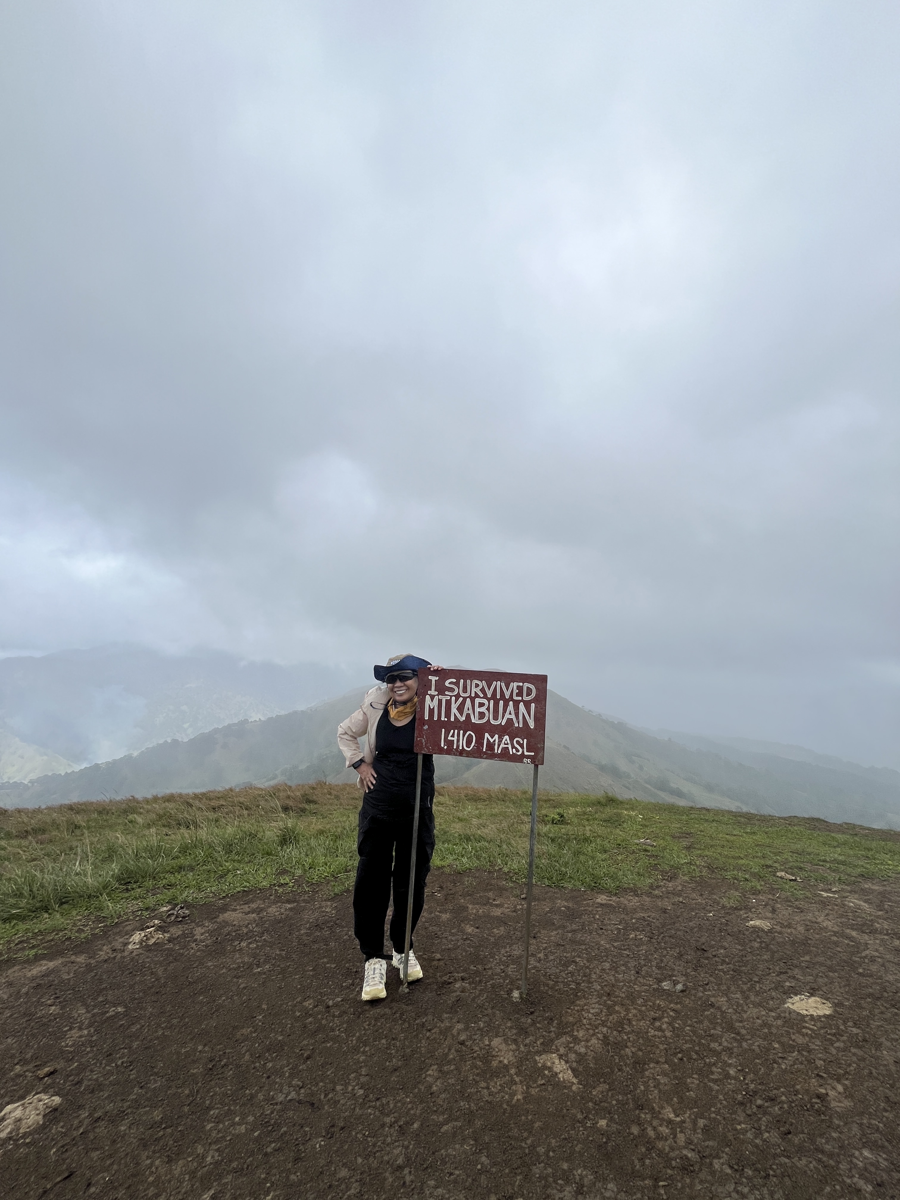
I would have loved to stay longer in this peak to celebrate my accomplishment, but poor Anne was already freezing. She didn’t have a jacket (apparently, she had a raincoat which she wore only when we were descending).
The lead pack decided to go for the full circuit by heading to the fourth peak, Mt. Sadjatan. It would have been just a quick 30-minute hike from Mt. Kabuan, according to Anne. But the lead pack had about 30-minute headstart, so the five of us who were left behind decided to head back. As the insider joke among hikers would say, wala nang dapat patunayan (there’s nothing left to prove).
Reinvigorated
I said at the beginning of this blog that I was seriously contemplating on retiring as a hiker. That mindset was brought on by about 3 months of not climbing any mountain due to inclement weather.
Until this tri-peak hike to Alang Salacsac, Nueva Vizcaya for the benefit of Cebu calamity survivors.
I kept telling Anne that we would be the last to reach the peaks. “Mahuhuli, pero makakarating (will come last, but will make it)”. The Lord does have mysterious ways of communicating.
So, yes, I might climb again. Please pray for me and the calamity survivors of Cebu and other devastated provinces.
NB: the hike organizer, HakbangPasulong, has already given the first wave of donations prior to this hike. The group will give the next wave of donations in the coming days.

